May 7, 2018

15th Annual Rabbit Creek

15th Annual Rabbit Creek
Come join us for one of the club’s favorite events, the CTOC Rabbit Creek meet.

This marks the 15th year the club will compete at this venue – challenging, fun and an adventure every time.
And don’t miss the potluck!

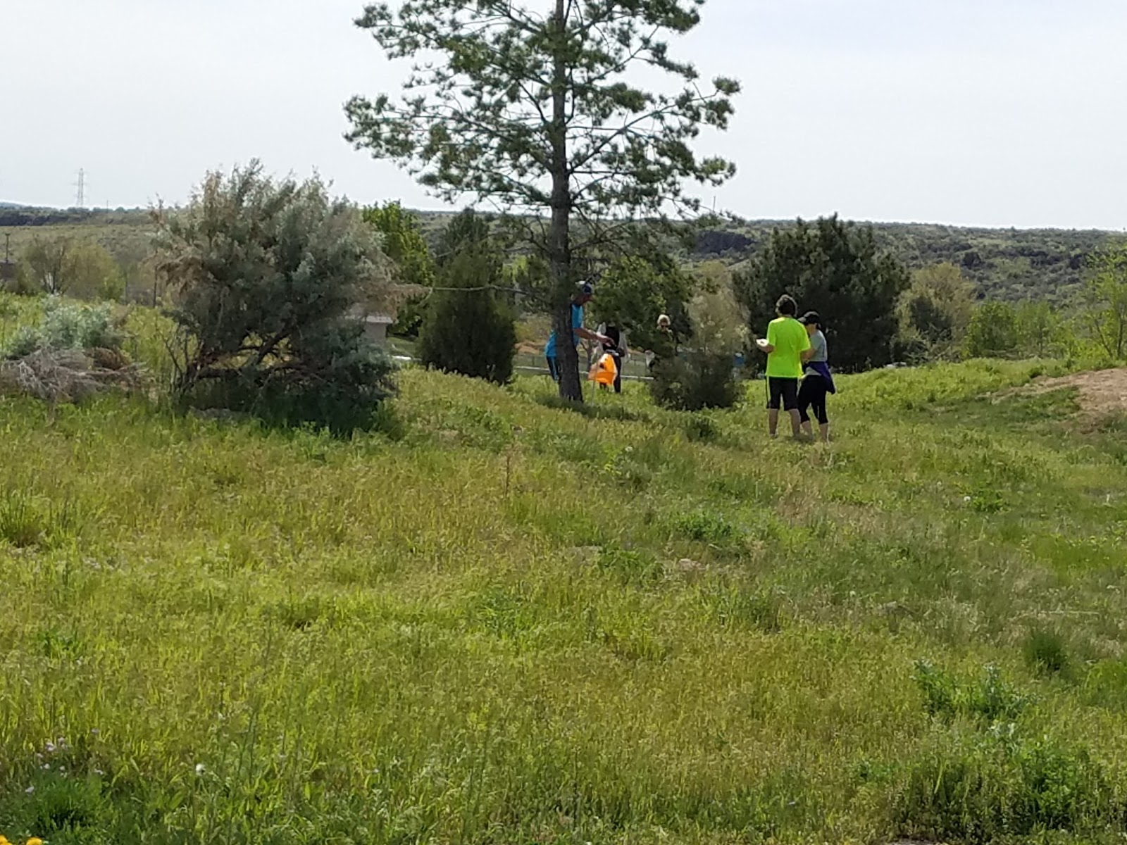
Located in the Owyhee mountains, it offers both beauty and ruggedness. The views during the meet are very scenic, wide open and full of unique rock formations.  The ruggedness includes some challenging steep and rocky terrain, brush, barb wire fences, ATV & ranchers and an occasional wild horse, rattlesnake or lizard.

And of course after the meet there will be the annual Rabbit Creek Potluck, so bring some food and beverages to share.

Basic Info
Date:             Sunday, May 20th
Location:      Rabbit Creek (Murphy, ID)
Formats:      Standard Courses - Beginner, Intermediate and Advanced
Starts:          After 10:00 am
Time Limit:   3 hours, the intermediate and advanced courses will be closed to starts
after at 11:30 am.

Costs
-        Single meet (day) dues: $10 per person/team, free for members 
-        Junior (up to 20 years old): $5 per person/team, free for members 
-        If more than one map is needed for a team, it is +$1 per map.
-        $2 SI stick rental, $1 compass rental.
-        You may join CTOC for the full year which makes all local meets free!  See member info.


Courses
Three levels of traditional classic orienteering courses will be offered:

  Beginner: 0.6-1.5km, 0-15m climb, 5-6 controls.  A short course right around the house and farm for those just getting acquainted with orienteering.

 Intermediate: 5-6 km, 250-350m climb, 8-13 controls.  A medium distance loop that takes a serious sightseeing tour of boulders and cliffs, requiring your full map reading attention.

  Advanced: 8-10 km, 400-500m climb, 16-22 controls.  A large loop with a full complement of technical controls and long legs.

Electronic punching will be used for advanced and intermediate courses so bring your SI stick or rent one from us at nominal charge. 


Recommended Equipment
 This venue is a strong contrast to our urban meets, so come prepared to handle the terrain and weather for May, which depending on the year can be very hot or much cooler and windy.  We will give an update during the week before the meet.
  • Compass of choice, base-plate or thumb compass works best for orienteering.
  • Sturdy shoes for off trail navigation.
  • Pants and/or gaiters for the high desert - cheat grass and sage being the most common.  Some barbed wire fence hopping or crawling required for the intermediate and advanced courses.
  • Hat and sunscreen for the bright sun conditions with little shade..
  • Water and food for up to 3 hours in the desert sun.  A water control is included halfway on the advanced course.
  • Whistle and cell phone for emergencies.  Cell phone coverage is not assured everywhere.

Keep in mind rattlesnakes are starting to get out at this time of year. We do not see any rattlesnakes very often but they are out there! So be watchful and listen especially around boulder areas and rock piles.
If you have any interest in birds, the ranch is an amazing place full of orioles, kingbirds, hummingbirds, buntings, and birds of prey.  Bring your binoculars to see them up close.

Also, the creek could be flowing higher this year; don’t lose a shoe in the muck. 


Reserving A Map / RSVP
Given the variety of courses, the impossibility of printing maps anywhere near the area, and the desire to minimize waste, please RSVP to me no later than Thursday May 17th with your name and intended course choice (and if you want an extra map or two for a larger group.)  
For RSVP and questions please contact: Michael Bading
My email is:  mbading AT syzeo DOT com  

We will have some extra maps on hand if you don’t let us know you are coming, but the supply will be limited and given out on a first come first serve basis.

Bring your event waiver prepared in advance especially if you are not a CTOC member, they can be printed from the website.

Driving directions to Rabbit Creek Ranch – Murphy, ID

-  From Boise take I-84 west to Nampa (Exit 35).
-  Turn Left and proceed to 3rd Street S (Caldwell Blvd).
-  Turn Left on 3rd Street S (Caldwell Blvd) and proceed to 12th Ave.
-  Turn Right on 12th Ave. Follow 12th Ave. south and it becomes Hwy 45 as it leaves Nampa city limits.
-  Follow Hwy 45 across the Snake River. Soon after crossing the river, bear to the left and it becomes Hwy 78.
-  Follow Hwy 78 to milepost 29.
-  Immediately after passing the "Murphy" city limits sign turn to the Right on "Old Hwy 45" follow this for one block then continue straight and it becomes "Rabbit Creek Road".
-  Follow Rabbit Creek Road for about 5 1/2 miles to J & S Road there is a lone mailbox.
-  Turn Left on J & S Road and follow this road approximately 1 1/2 miles to the house and sign in area.


Racing the Hub - Columbia Village April 2018 Results

Multiple competitors merging at the hub control
Sixteen competitors showed up for a run through the parks on a windy Saturday morning. Most (9) opted for the slightly longer Expert course. The the number and distribution of starts was about right for plenty of traffic in and around the hub and no following. Competitors enjoyed seeing others moving to and from the hub in different directions.

Every time I use the OE software for SportIdent timing I learn something new. This time I learned that it does matter what time you enter as "Zero time". If you plan to start your meet at 11am, and set zero time for 11am, don't send anyone off early (or set an earlier zero time to be safe time). Apologies to John Murray, Jerry Stewart, and Thomas Bernier for whom I do not have split times (they magically completed the course in a negative time). I was able to manually calculate their overall times. Lessons learned for next urban sprint competition: a single intermediate/expert course (maybe with an option for a second loop for those who need more running), something closer to an orange level advanced novice course, and a programmed zero-time that is earlier than the earliest start!

Newcomers included Boy Scouts Isaac Koudelka, Brigham Jensen, and Gavin Bishop. It was good to see Kara Steele, Roxanna Strong, and Thomas Bernier out again, and Karin Didesse making the trip from McCall. It was also good to see regulars working hard in some higher heart rate zones for the shorter distance course.
Sergey and Ben matching paces in opposite directions

Results:

Beginner
  1. Isaac Koudelka, Brigham Jensen, Gavin Bishop - 0:29
Intermediate
  1. Thomas Bernier - 58:02
  2. Kara Steele and Roxanna Strong - 59:48
  3. Norma Bailey - DNF
Expert
  1. Sergey Velichko - 23:14
  2. Ben Brock - 24:36
  3. Jeff Black - 27:07
  4. Emily and Nicola Morgan - 32:42
  5. John Murray - 38:45
  6. Karin Didesse - 39:50
  7. Kerry Davis - 41:02
  8. Jerry Stewart - 1:41:32
Splits are available at WinSplits online, including splits for experts who ran the intermediate loop for additional practice (at least John gets a chance to see some splits for that course):
    Split times, WinSplits Online
Hope to see you at Rabbit Creek on May 20!

CV 2018 Race Director,
Melanie Wright

April 25, 2018

New Date for Rabbit Creek

Heads up!
Rabbit Creek will be moving to Sunday May 20th.
Stay tuned for additional details.

April 24, 2018

April 28 Meet at Columbia Village

When: Saturday April 28, starts between 11am and 11:30am (expect everyone to be finished before 1pm). Email me (melaniecwright AT gmail DOT com)  if you need a different start time.

Location: Start at Columbia Village Recreation Center, 3655 E Lake Forest Dr. There are no bathrooms at the start, but there are some nearby at the Simplot recreation fields. Finish will be on the map and within 400 meters of the start. 

Format: Urban Sprint. Advanced(~4.5km), intermediate (~3km), beginner (~1km). Run the class that is closest to your competition level first in the 11 - 11:30am start window for official scoring. You may run other classes for fun/practice after that if you like. There will be shared controls on the courses. There will be close controls on the courses so check control codes and avoid mis-punches. Do not assume other runners are running the same course as you. 


Electronic punching will be used for advanced and intermediate courses so bring your SI stick or rent one from us at nominal charge. 

Club members will be on hand for instruction/coaching. If we have a large group of novices wanting instruction, we will have a group lesson at 10:30am. We do need RSVPs to know how many maps to print and whether to plan on a training session.

Cost:  
  • Single meet (day) dues: $10 per person/team, free for members 
  • Junior (up to 20 years old): $5 per person/team, free for members 
  • If more than one map is needed for a team, it is +$1 per map.
  • $2 SI stick rental, $1 compass rental.
  • You may join CTOC for the full year which makes all local meets free!  See member info.
RSVP:  Via Facebook https://www.facebook.com/events/2006929216003251/ or email me directly  (melaniecwright AT gmail DOT com) with your count and maps needed by Thursday, April 26. If you are planning to bring a large group, please let me know so we can be sure to accommodate you.


Bring:
  • Compass!
  • Waiver, prepared in advance especially if you are not a CTOC member.
  • Essentials and snacks. We will have drinking water and light snacks at the meet center.
  • Sunscreen and/or hat if sunny.
  • Clothing suitable for outdoors and weather. 
Hope to see you our for a fun and fast adventure!
Melanie Wright

March 31, 2018

New Date for April Meet

Please note that we have re-scheduled the April meet to Saturday April 28. Plans for the the April 28 meet are for a course that will have as many people as possible moving in different directions in a relatively small area, so we are offering a much tighter start window. The meet will be appropriate for all levels. Feel free to contact Melanie if you need to make adjustments. Hope to see you there!

March 19, 2018

March 17 Meet at Ann Morrison park results

Snow and rain didn't cause much disruption to all the outdoor activities in Ann Morrison and Julia Davis parks and BSU campus including St. Patric's 5K run, rugby, March Madness, disk golf tournament, and our orienteering meet.

Skillful and careful navigation was required to avoid tons of outdoor enthusiasts and barriers in the campus. Few action photos from the meet:


Here are results per course.

Beginner 1.8km, 8 controls
Roxana and Kara Steele                             35:10
Jason Rowley                                             14:15


Advanced (5/5)7.0 km 0 m16 CStatus of: 1:23 PM
PlStnoNameYBClubCl.Time
11Black Jeff
Advanced42:22
24Morgan Jay
Advanced50:07
35Morgan Aleksi-Emily
Advanced1:01:29
46Wright Melanie
Advanced1:13:20
52Stewart Jerry
Advanced2:17:14


Intermediate (3/3)5.0 km 0 m11 CStatus of: 1:23 PM
PlStnoNameYBClubCl.Time
18Murray John
Intermediate46:04
23Davis Kerry
Intermediate1:02:33
37Rowley Jason
Intermediate1:08:10

Electronic split time for Intermediate and Advanced courses is available in here Split times, WinSplits Online.

Hope to see you all at our next meet Sunday April 15, Simplot Sports Complex, 11am - 1pm starts. More information will be available closer to the meet.

Yours,
Sergey Velichko

March 9, 2018

March Meet at Ann Morrison park

When:  Saturday, March 17.  Starts from 11:00 am - 1:00 pm.   Course closes at 2pm, so if you want more time you should come earlier in the window.
Location:  Ann Morrison park in Boise, Old Timer's shelter. Enter park from East at W. Royal Bldv, and park close to Boise parks and rec building. 
Format:  Classic:  Advanced (8-10km), Intermediate (5-6km),. and Beginner (2-3km) Course. Advanced and intermediate courses will venture into Julia Davis park and BSU campus. Electronic punching will be used for advanced and intermediate courses so bring your SI stick or rent one from us at nominal charge.
Club members will be on hand for instruction/coaching. If we have a large group of novices wanting instruction, we will have a group lesson at 10:30am. We do need RSVPs to know how many maps to print and whether to plan on a training session.
Cost:  
  • Single meet (day) dues: $10 per person/team, free for members 
  • Junior (up to 20 years old): $5 per person/team, free for members 
  • If more than one map is needed for a team, it is +$1 per map.
  • $2 SI stick rental, $1 compass rental.
  • You may join CTOC for the full year which makes all local meets free!  See member info.
RSVP:  I will pre-print maps enough for our usual attendance, however, if you plan to come as a part of a large group please email me directly  (savelichko AT yahoo DOT com) with your count and maps needed by Thursday, March 15.
Bring:
  • Compass!
  • Waiver, prepared in advance especially if you are not a CTOC member.
  • Essentials and snacks. We will have drinking water and light snacks at the meet center..
  • Sunscreen and/or hat if sunny.
  • Clothing suitable for outdoors and weather. 
Hope to see you all enjoying the park and courses!
Yours,
Sergey Velichko

February 16, 2018

Orienteering Results from Badger Hole

Typical Badger Hole Terrain
A few weeks ago I wrote that I hadn't selected an name for the February 4 orienteering venue and solicited suggestions. Well, while driving to the event a sign for a business caught Ben Brock's attention. I don't recall the type of business, but I do remember the key words: “Badger Hole”. One thing you notice while orienteering on this site is the number of badger, fox and prairie dog holes. On the Tuesday before the meet Sergey Velichko ran the course in its preliminary design phase in less than an hour. He reported badger holes causing him to fall twice before he slowed his pace and began spending more time looking at his foot placement. Henceforth this venue will not be known as Firebird or Freeze Out. It's Badger Hole.

There's not a tree to be found. There's not a boulder anywhere. With the exception of the clusters of animal dens this is highly runnable terrain. Navigation is all about contours and the network of ORV trails. The course design minimized the utility of the trails, placing the navigational burden on reading the contours.


Those of you who are familiar with cheat grass, medusahead and other noxious grasses know how annoying squirreltail can be. Usually, the seeds have fallen to the ground by February. That was not the case this year. Whatever we might think the benefits of the mild winter, it appears that squirreltail penetrating shoes and clinging to socks is not one of them. Adequate gaiters, resistant shoes and/or unconventional
Norma and Bonnie in their duct taped shoes
means of protection were necessary. The accompanying photo of Bonnie's and Norma's duct tape clad shoes exhibits one effective strategy. 

The weather was good. The temperature was mild. The terrain was in remarkably good condition for a February meet—dry without being frozen. It was pretty much an ideal morning to orienteer on a fun new map in our foothills. Regrettably, only five orienteers came out. Jeff Black and Ben Brock ran the 7.5 kilometer advanced course. Ben finished in 1:08 and Jeff ran it in 1:40. Carrie Magnuson completed the 3.4 kilometer intermediate course in 1:04. The team of Norma Bailey and Bonnie Coiner was unable to find a couple of controls. I expect they will do much better next month at Ann Morrison Park.

Thanks to Ben for picking up most of the controls. Ben came pretty close to running the course twice.

Sergey will direct the next meet on the Ann Morrison map he has expanded once again. We hope to see you there on Saturday, March 17.

John Murray
Meet Director

January 24, 2018

February Meet on a New Map at Firebird

There are two things yet undetermined about our next orienteering meet. First, because wet conditions can make responsible orienteering impossible due to the potential for contributing to trail erosion, we can't set a firm date until the weather forecast is agreeable. As I write this post, the next likely date is Super Bowl Sunday, February 4. Mark your calendars lightly in pencil. Second and much less important, I haven't selected a name for this new venue. The eminently runnable terrain calls for a name like "Runner's World". The proximity to the Firebird Raceway invites "Firebird". The season of cold, rain and snow and the location above Freezeout Hill make a good fit for "Freezeout".  Perhaps, someone with a decisive mindset will annihilate my ambivalence.

Whatever we call it the parking area lies about 1 3/4 miles north of Beacon Light Road on Highway 16.  https://drive.google.com/open?id=1ONqvHcC6lrxJ59BuyauNO_4VDfb9GGg0&usp=sharing  

The topography allows design of a Beginner Course. However, it is not one of our better beginner areas.
When:  Sunday, February 4  Starts from 9:00 - 10:00 AM.   Course closes at noon, so if you want more time you should come earlier in the window.
Location:  Firebird??? map.  This link highlights where to park.  Drive north on ID16 (towards Emmett) until 1 3/4 miles past Beacon Light Road.  There is a parking area on the west side. If you reach the Firebird Raceway you will have gone too far. 
Format:  Classic:  Advanced (~8km, ~400m climb), Intermediate (~3.5km, ~155m climb). If you are interested in a Beginner Course, please contact me by Tuesday, January 30.
Cost:  
  • Single meet (day) dues: $10 per person/team, free for members 
  • Junior (up to 20 years old): $5 per person/team, free for members 
  • If more than one map is needed for a team, it is +$1 per map.
  • You may join CTOC for the full year which makes all local meets free!  See member info.
RSVP:  To minimize waste, please email me (jnm2870 AT cableone DOT net) with your count and maps needed by Friday, February 2.    If you show up off the cuff, I will probably have a few blank maps to copy a course by hand.
Bring:
  • Compass!
  • Waiver, prepared in advance especially if you are not a CTOC member.
  • A suitable pack with essentials and snacks as you usually need to prepare for a day hike in the foothills.
  • Sufficient water for yourself.  
  • Sunscreen and/or hat.  This is very exposed terrain.
  • Clothing suitable for extended hiking in foothills brush.  This is surprisingly runnable terrain but there will be some areas of large sagebrush, bitterbrush and other plants.  
  • Gaitors are highly recommended as there is an abundance of very annoying squirrel tail grass.
  • Shoes for steep  terrain.  If your ankles are sensitive please prepare accordingly.
  • Cell phone. I can not vouch for coverage, so be prepared with a whistle and other fallback options.
Important notes:  
  1. There are NO restrooms in the parking area or on the map.  Closest available facilities are probably at Emmett.
  2. I don't know what the rules are for dogs, but with the intersecting ORV trails I'm confident that well controlled dogs will not be a problem.  
  3. There are a few barbed wire fences around.  As always be alert to loose strands around as always watch where you run and step.Hope to see you out navigating with us Sunday!
John Murray

January 17, 2018

Facebook Page Live and other Social Network news

We've reinstated our Facebook Page https://www.facebook.com/CTOCBoise/ and also now have an instagram account (ctoc_orienteering).

We will be posting meets as Events on Facebook to make it easy for you to RSVP and to get notifications of changes.  If you are not a Facebook user, you can still check our blog and we will still send Yahoo Groups emails. We are trying to limit group emails and use the great features in social networks to help us manage meet communication so we encourage you to check it out.

If you have other ideas for information sharing and getting more Idaho folks out to orienteer, please let us know. We are also looking for additional volunteers to help the club out with marketing and networking (not a major commitment). Let us know if you are interested in that or have time to volunteer in other capacities (eg, co-directing a meet).

The upcoming January 28 (date and time is flexible because of weather) meet is now posted as an event on Facebook.  Hope to see you out there!