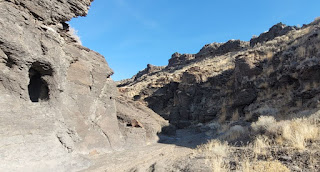
Last Sunday was a beautiful, nearly spring-like day to be out rambling around the desert of south central Idaho. Thank you to everyone who came out! We had 24 participants on 1 map, with options for three official courses.
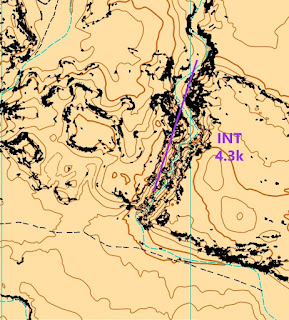
This was the first meet on this new map! Great to have a place outside the city parks for a winter meet, don't you agree? The map was mostly computer generated, but AI doesn't get you all the way there. After a day spent in the field John and I agreed that the cliffs on the map we were using did not accurately represent what we saw in the field. Below are the two versions that demonstrate why having LiDAR data is so beneficial, but field work is invaluable.
To keep it simple, we used one map with all three routes, which left folks lots of options and choices when out and about. At least 8 of the participants/teams changed maps, going both shorter and longer.
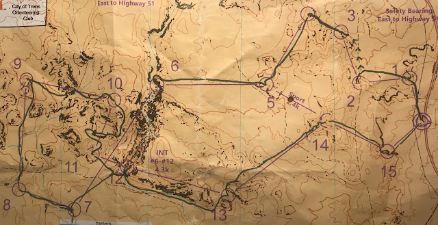
The changes back and forth in courses represent the many challenges and pleasures found out on the course. It seems that while the contours could have been a bit darker to make more obvious, some of the more obvious clues for controls were missed, such as the trail leading from near control 2 and 3 and the control description for 6 indicating the location at the bottom of the cliff. The undulating terrain made for good compass practice, also while allowing reliance on the map features for some controls. Check out Sergey's winning route below the results table. Did you have any additional comments on the map or this location? Please let us know, as I hope we will use this area again!
This wasn't a bad place to hang out while waiting for over 2 hours for the first finishers. I had lovely sunshine, beautiful views, and Norma's pleasant company. I could occasionally make out a number of folks wandering around looking for a control with my binoculars. Thank you, Marcella, for the group picture below of Ted, myself, Innes, and Dipesh after they had all completed their courses and we were waiting for other finishers. Whether you were out for a stroll or have a more competitive day, I'm glad you made it out.
Results are shown below. They are sorted by overall times since the times were "all over the map." There were enough course changes that I feel like I may have missed something like a DNF, so please let me know if I did. As mentioned previously many folks started on one maps and then changed courses.
For those of you that are curious, Sergey has provided his route. He made a mistake between control 10 and 11, misreading the contours, before getting back on track. Notice his use of the trail between control 2 and 3 that should have made it straightforward.


 <<< Map 1


No comments:
Post a Comment